

Andrew Brunner
Predicting Amphibian Road Crossing Hotspots
Abstract:
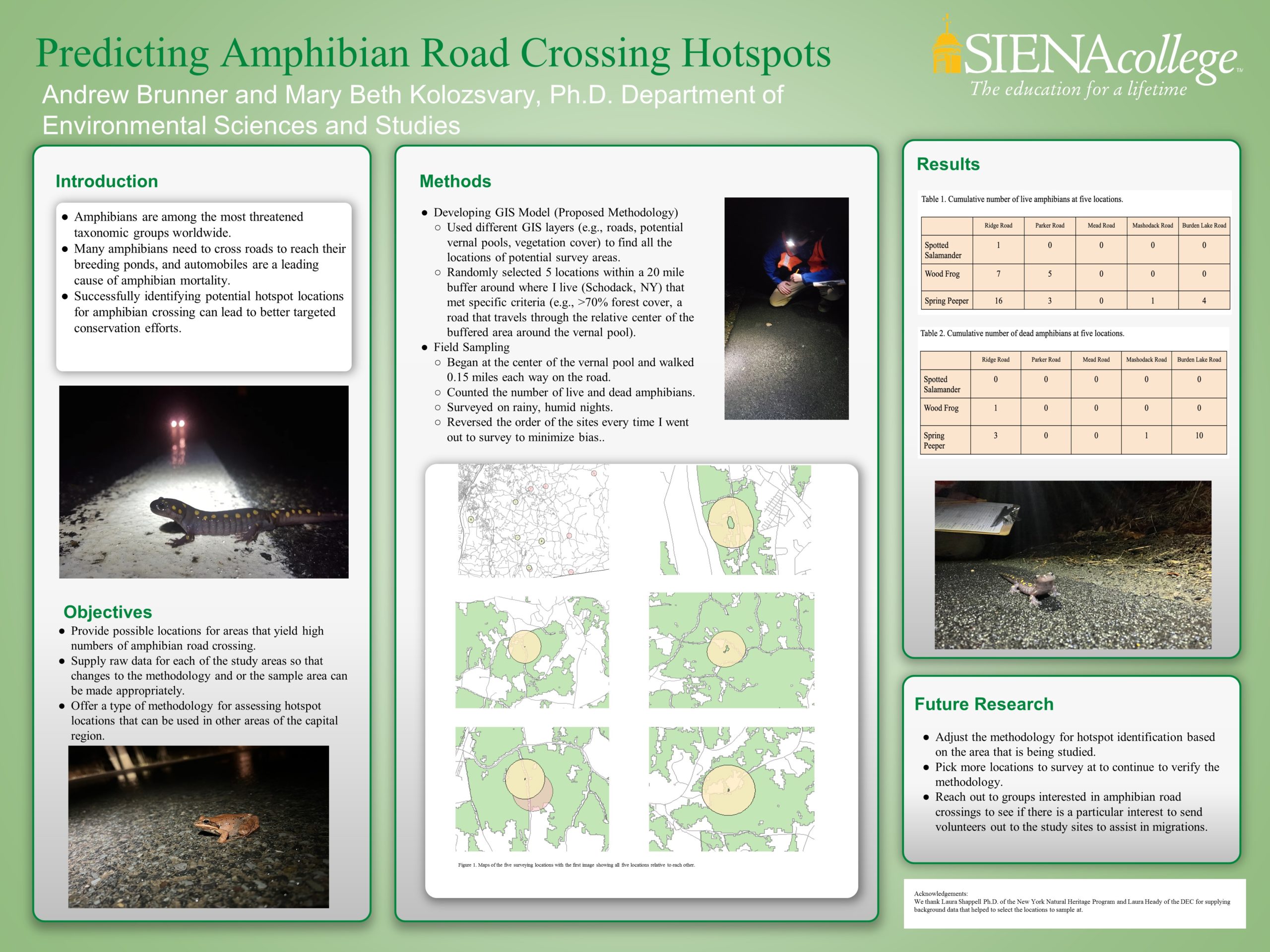
This research looked at identifying potential road crossing hotspot locations where amphibians would most likely be crossing the road upon breeding season. To predict potential places to survey at, I used many different GIS layers such as “Percent Forest Cover”, “Roads”, and “Vernal Pools” to select for potential sampling locations. From these locations, I randomly selected 5 locations in southeastern Rensselaer County (which is where I live) to sample at. Ideal weather conditions were necessary for field sampling as amphibians use warm, rainy nights in early Spring to travel to their breeding grounds. At each location, I marked a midpoint where the vernal pools would be at each location and used this as a baseline for measurements at each of the 5 sites. I then walked 0.15 miles each direction on the road from the vernal pool (total of 0.3 mile stretch of road). I surveyed, following all protocols and counted the living and dead amphibians at each site. After data collection, it is evident that my proposed methodology was sufficient enough in predicting hotspot areas for amphibian crossing and can be used as a template for expanding on current knowledge of places where amphibians will most likely be active.
Title
Predicting Amphibian Road Crossing Hotspots
Faculty Advisor
Dr. Mary Beth Kolozsvary
Course
Independent Study (SCDV 499)
Presentation Type
Poster
Location
Table 34